Symbianize Forum

Most of our features and services are available only to members, so we encourage you to login or register a new account. Registration is free, fast and simple. You only need to provide a valid email. Being a member you'll gain access to all member forums and features, post a message to ask question or provide answer, and share or find resources related to mobile phones, tablets, computers, game consoles, and multimedia.

All that and more, so what are you waiting for, click the register button and join us now! Ito ang website na ginawa ng pinoy para sa pinoy!

AutoCAD Users TAMBAYAN!

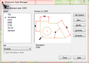
sa layout po ba tama maglagay ng dimentions, at pano po gagawin para mabasa siya pag na plot na kasi po yung ginagawa ko ay maliit at di na makita pagnaplot na


ideally po sa model naglalagay ng annotations at dimension

FWIW set mo po ang text height sa 1.8mm or 2.5mm pag gumawa ka ng Text Style at Dimension Style.

Double Check din yung lineweight nung layer ng Text / Dimension baka masyadong makapal kaya di mabasa.

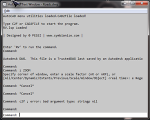
Sir tanong ko lang paano mainsert uli yung jpeg na picture sa autocad na nawala pero dapat tama ang isertion point at size niya at coordinate


click mo po yung "..." sa "Saved Path" under Xref Manager then browse for the file lang para ma reload yung image.
 
ideally po sa model naglalagay ng annotations at dimension

FWIW set mo po ang text height sa 1.8mm or 2.5mm pag gumawa ka ng Text Style at Dimension Style.

Double Check din yung lineweight nung layer ng Text / Dimension baka masyadong makapal kaya di mabasa.

ok thank you po sir

- - - Updated - - -

ideally po sa model naglalagay ng annotations at dimension

FWIW set mo po ang text height sa 1.8mm or 2.5mm pag gumawa ka ng Text Style at Dimension Style.

Double Check din yung lineweight nung layer ng Text / Dimension baka masyadong makapal kaya di mabasa.

ok thank you po sir
 
welcome po :hat:
 
ideally po sa model naglalagay ng annotations at dimension

FWIW set mo po ang text height sa 1.8mm or 2.5mm pag gumawa ka ng Text Style at Dimension Style.

Double Check din yung lineweight nung layer ng Text / Dimension baka masyadong makapal kaya di mabasa.

ok thank you po sir

- - - Updated - - -

ideally po sa model naglalagay ng annotations at dimension

FWIW set mo po ang text height sa 1.8mm or 2.5mm pag gumawa ka ng Text Style at Dimension Style.

Double Check din yung lineweight nung layer ng Text / Dimension baka masyadong makapal kaya di mabasa.

ok thank you po sir

Sir,

na subukan mo na ba the following:
[D] - dimension style manager
Modify/New
tapos sa Primary units Tab nya, merong scale factor at default nya is 1.000

for me, i use this for my drawings scaled to 1:100, if i wanted a new scale say 1:50, what i usually do is the change that field Scale Factor into 2.000 for 1:50 so on and so forth...

after that you could use the appropriate dimension style to each scaling nang drawing mo...

me inattach akong png file = D100 is my Dim Sty for drawings that i show using 1:100, D050 is my Dim Sty for drawings that i show using 1:50, D025 is my Dim Sty for drawings that i show using 1:25 and so forth.
 

Attachments

  • Dimension.PNG
    Dimension.PNG
    54.1 KB · Views: 11
Re: AutocAD Users...dito na lang kayo

ts, may civil 3d 2014 user guide ka ba?
 
Sir PESSI,

i tried to use one of your lsp named CAD2FILE which was supposed to create legends out of the layers which is of very great help in my field. it returned with the following error as attached in the below. i already directed the path of the apps directory to be searched but to no avail. any suggestions or recommendations??? thanks in advance for the assistance.
 

Attachments

  • Error.PNG
    Error.PNG
    58.3 KB · Views: 7
Galing..meron palang thread para sa mga AutoCAD user...

First time ko dito.. Hello sa lahat.. =)
 
Re: AutocAD Users...dito na lang kayo

hello po sino po my alam lagyan ng Ge-survey ang autocad na 2007 or 2009? :help: sa ofis ksi meron gusto ko sna lipat sa laptop ko kso di ko alam panu kng meron kayu ng Ge-survey pahinge po ng link :pray: mas madali po ksi kapay meron GE-survey ang autocad pra saken :thanks: po in advance sa mkkatulong saken :)


Upload mo dito yong file ng GE-survey try natin kung gagana sa ibang pc:thumbsup:
 
Sir PESSI,

i tried to use one of your lsp named CAD2FILE which was supposed to create legends out of the layers which is of very great help in my field. it returned with the following error as attached in the below. i already directed the path of the apps directory to be searched but to no avail. any suggestions or recommendations??? thanks in advance for the assistance.

paki attach nga po yung CAD2FILE? di po yan sakin sir..
eto po yung link nyan.
 
Galing..meron palang thread para sa mga AutoCAD user...

First time ko dito.. Hello sa lahat.. =)

:hi: welcome po sa thread :hat:
 
paki attach nga po yung CAD2FILE? di po yan sakin sir..
eto po yung link nyan.

Sir i clicked on your link and it was not i was hoping for... anyway... attaching one of my files...

Sir, my main conceern is that I am looking for an app that could extract the layers and turn it into legend at paperspace.

if it could extract the data such as area, then it would be way much better than drawing it manually one by one.

If you are familiar with AcrView wherein you just insert the Legend and it automatically puts all active layers (Data or feature in ArcGIS) where you have the option to show whether to include the geometry calculation or perimeter or count or whatever... hope you get what i mean...

Thanks a lot po in advance TS
 

Attachments

  • Master Plan Draft.rar
    1.8 MB · Views: 30
Last edited:
Sir i clicked on your link and it was not i was hoping for... anyway... attaching one of my files...

Sir, my main conceern is that I am looking for an app that could extract the layers and turn it into legend at paperspace.

if it could extract the data such as area, then it would be way much better than drawing it manually one by one.

If you are familiar with AcrView wherein you just insert the Legend and it automatically puts all active layers (Data or feature in ArcGIS) where you have the option to show whether to include the geometry calculation or perimeter or count or whatever... hope you get what i mean...

Thanks a lot po in advance TS


:think: not familiar with that sorry...
 
:excited:Magandang Araw po sa Lahat... san man kayong sulok nang mundo:excited:

Ala lang magawa, so greet ko na lang lahat... Next month, simula na nang BRRRR months, meaning, malapit na ang pasko at simula na akong mag-ipon para sa happenings...

M = move
E = erase
R = refresh
R = refresh
Y = ala yata eh, maliban sa confirmation sa Y/N

C = copy
H = hatch
R = refresh
I = insert block
S = select objects
T = multiple text
M = move
A = arc
S = select objects

(para walang masabi si boss pessi, at least merong CAD related din topic din akong nai-post):salute:
 
sir if meron kayo ng auto cad 2013
pahinge nalng po ng dl thanks in advance po
 
sir if meron kayo ng auto cad 2013
pahinge nalng po ng dl thanks in advance po

hanap ka na lang po sa PC apps sir...
hirap kc mag upload ng illegal software dito sa eh..delikado
 
sino po marunong dito sa mga blueprints?
magpapatulong lang kasi ako kung paano gumawa ng floor plan ng bahay, project kasi namin eh. wala talaga akong alam nito, 0. :slap::noidea:
ipapass na namin next week. :panic:
 
sino po marunong dito sa mga blueprints?
magpapatulong lang kasi ako kung paano gumawa ng floor plan ng bahay, project kasi namin eh. wala talaga akong alam nito, 0. :slap::noidea:
ipapass na namin next week. :panic:

uso pa din ba blueprints? :think:
 
uso pa din ba blueprints? :think:

master pess, dito uso pa din yun hehe... masyado pang malayo ang BIM para maging ganun ang mga contractor dito eh.. hehe
tsaka okay na din sa mga pipirma sa mga drawings.. isang pirmahan nalang sa tracing paper.
 
Back
Top Bottom