Symbianize Forum

Most of our features and services are available only to members, so we encourage you to login or register a new account. Registration is free, fast and simple. You only need to provide a valid email. Being a member you'll gain access to all member forums and features, post a message to ask question or provide answer, and share or find resources related to mobile phones, tablets, computers, game consoles, and multimedia.

All that and more, so what are you waiting for, click the register button and join us now! Ito ang website na ginawa ng pinoy para sa pinoy!

Earthwatch: Because....

attachment.php


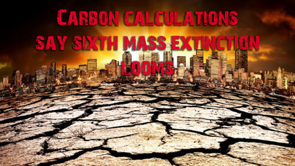
The numbers don’t lie: the world is heading for a sixth mass extinction event, and the point of no return lies just 80 years ahead.

That’s the conclusion of geophysicist and mathematician Daniel Rothman from the Massachusetts Institute of Technology in a paper published in the journal Science Advances.

Rothman, who has previously been awarded for his mathematical analysis of the carbon cycle, set out to analyse available data relating to the five previous mass extinctions – including the Permian event, which saw the end of 95% of all marine species – and see what, if any, conclusions could be drawn in relation to today’s climate modelling.

The study began from the proposition that every mass extinction, the first of which began around 540 million years ago, could be characterised as a major disruption to the Earth’s normal carbon cycle.

The other condition each shared was timescale: the carbon disruptions, and thus the extinctions, took place over thousands, even millions, of years. Rothman wanted to find out how the mathematics used to describe events of that magnitude compared with the equations needed to describe the current conditions, which are propelled by a rapid accumulation of carbon that began much more recently.

“How can you really compare these great events in the geologic past, which occur over such vast timescales, to what's going on today, which is centuries at the longest?” he says.

“So I sat down one summer day and tried to think about how one might go about this systematically.”

He began by classifying carbon-change events as either long or short in duration. Then he combed through hundreds of geo-chemical papers to find occasions on which big disruptions happened in the Earth’s carbon cycle.

He identified these by measuring changes in the relative abundance of two isotopes, carbon-12 and carbon-13. For each of these ratio changes, he also noted the length of the event, expressed as the time it took for the carbon cycle to return to equilibrium.

Eventually, he found 31 events that matched his criteria, including the five previous mass extinctions. The task then was to identify what conditions divided the extinction events from the non-catastrophic carbon changes.

By analysing the isotope ratio changes he was able to devise a formula that described the total mass of carbon that was added to the Earth’s oceans for each event. It became clear that there was a threshold in play.

“It became evident that there was a characteristic rate of change that the system basically didn’t like to go past,” Rothman says. “Then it became a question of figuring out what it meant.”

Four of the five mass extinctions were beyond the threshold, with the biggest of them all, the Permian, the furthest away from it.

He went back to his earlier work, in which he constructed equations to describe the carbon cycle as a loop cycling between photosynthesis and respiration. His modelling included a “leak” function: a proportion of the total carbon mass that over any given period sinks to the ocean floor and becomes buried, effectively removing it from the equation.

The critical function in the model, therefore, was the rate at which carbon (as carbon dioxide) enters the system above the rate at which the leakage removes it. This additional carbon cannot be accommodated within the loop equation.

The increase in excess carbon, Rothman determined, crossed the threshold over long timescales if it grew faster than the global ecosystem could adapt to it. Over shorter periods, the rate of excess carbon production didn’t matter. Instead, the overall magnitude of the change was the determining factor.

Crunching all the numbers, Rothman concluded that in the current circumstances the threshold will be crossed when the amount of carbon pumped into the ocean – above the sequestered leakage amount – hits 310 gigatonnes.

Best-case scenario modelling by the Intergovernmental Panel on Climate Change predicts that that by 2100 the actual added ocean carbon load will just scrape under that target, at 300 gigatonnes. Every other scenario lands substantially above it.

Rothman is quick to add that if the threshold is reached catastrophe will not suddenly unfold in the year 2101. Instead, the process could take as long as 10,000 years.

That, however, is no reason for complacency or inaction.

“This is not saying that disaster occurs the next day,” he says.

“It’s saying that, if left unchecked, the carbon cycle would move into a realm which would be no longer stable, and would behave in a way that would be difficult to predict. In the geologic past, this type of behavior is associated with mass extinction.”


SOURCE
 

Attachments

  • sixth mass extinction02-final.jpg
    sixth mass extinction02-final.jpg
    320.6 KB · Views: 70
A Major Antarctic Glacier Just Lost a Massive Chunk of Ice the Size of an Island


Last edited:
attachment.php


Plate tectonics began somewhere between 3 and 3.5 billion years ago, and as result, Planet Earth became a world full of volcanoes, earthquakes, oceans, and continents. We understand the processes that drive it, but how did it all begin?

A new Nature Geoscience study has a rather remarkable answer: massive asteroid and meteorite impacts kickstarted the formation of mountains, valleys and everything in between. They may have even helped trigger the formation of our planet’s magnetic field, without which life on Earth would all but cease to exist.

The international study, led by researchers at Macquarie University (MU), looked further back in geological time than most, right to the beginning of our planet, 4.5 billion years ago. Shortly after the planet formed from the embers of the Solar System’s violent birth, it developed a shell – a singular crust – that covered the entire world.

Then, between 4.1 to 3.5 billion years ago, the remnants of failed planets and comets began to rain down on the larger worlds out there, including our own. This was known as the Late Heavy Bombardment, and the team wanted to know if it had any effect on plate tectonics.

Setting up a cutting-edge computer model of the Hadean eon Earth, the team simulated several massive impacts on the crusted-over, superheated planet – including one proto-planetary body that was 1,700 kilometers (1,056 miles) across.

“Our results indicate that giant meteorite impacts in the past could have triggered events where the solid outer section of the Earth sinks into the deeper mantle at ocean trenches,” lead author Associate Professor Craig O’Neil, from MU, said in a statement.

The process being described there is subduction, the very same process that leads to the destruction of tectonic plates, the formation of mountains, volcanoes, and the world’s most powerful earthquakes. Tectonic plates can’t drift around if older ones aren’t being destroyed, which means that the very first moment that subduction occurred, plate tectonics officially began.

The researchers also suggest that such impacts – if they were powerful enough to induce subduction – could have caused pandemonium in Earth’s liquid outer core too. Like a cannonball landing on a frozen lake, the molten material trapped beneath the solidified surface would have been pushed around and mixed up.

This would have exacerbated the already massive temperature difference between the inside of the planet and the outer layers. Even if enormous convection currents in the outer core were already going, this would have only amplified them.

These liquid metal convection currents are responsible for generating the planet’s magnetic field – so there’s an argument to be made that without these giant impact events, that wouldn’t exist either.

It’s worth pointing out that this is all based on a computer simulation. Physical evidence for literally anything on Earth older than 4 billion years old is impossible to find, as it was all destroyed during those hellish early days of planetary evolution.

This means that all scientists can do is use simulations, and observations of other planets, to speculate, albeit conservatively and carefully.

“We know that meteorite impacts had a huge effect on the inner solar system at this time,” O’Neill said, adding that “you only need to look at the Moon to see that. What isn’t clear was how our own impact history might have affected the planet’s evolution.”

Nevertheless, if true, this hypothesis paints a beautifully paradoxical picture of our world, one in which frequent acts of unadulterated destruction were inadvertently responsible for kickstarting plate tectonics, the generation of a magnetosphere – and, by consequence, life itself.

SOURCE
 

Attachments

  • asteroidsplatetectonics-final.jpg
    asteroidsplatetectonics-final.jpg
    440.1 KB · Views: 61
attachment.php


For every ton of carbon dioxide emitted by a power plant's smokestack or a car's exhaust pipe, some portion will stay in the Earth's atmosphere, raising global temperatures, while the rest is absorbed by the oceans or ecosystems on land.

But which parts of the ocean or biosphere act as net sources of carbon dioxide (CO2) and which take up more than they emit into the atmosphere, has been an open question. Figuring that out, as well as understanding what mechanisms govern that interplay and how they might change along with the climate, has been an open question and one that is key to understanding how global warming will progress.

The 2014 launch of the Orbiting Carbon Observatory-2 satellite was aimed at beginning to piece together some answers by monitoring the comings and goings of CO2 from the atmosphere with unprecedented precision and over large regions. [The Reality of Climate Change: 10 Myths Busted]

So far, the mission has done that and has turned up some surprises along the way. The mission serendipitously coincided with one of the strongest El Niños (an ocean and atmosphere cycle that impacts global weather) on record, allowing scientists to see how the carbon cycle responded and pinpoint exactly where the resulting record pulse of CO2 that entered the atmosphere came from. The satellite's instruments also unexpectedly proved capable of distinguishing the relatively small CO2 signatures of cities and even volcano plumes.

"We're very, very happy with these results," deputy project scientist Annmarie Eldering, of NASA's Jet Propulsion Laboratory, told Live Science.

But the findings, described in series of five papers in the Oct. 13 issue of the journal Science, are just the first steps at getting a better handle on the carbon cycle (how carbon flows through land and sea ecosystems and the atmosphere), as OCO-2 heads into an expected extended mission and other space-based projects are scheduled to follow in its wake.


LUCK AND SURPRISES
Carbon dioxide is added to and removed from the atmosphere by a range of competing processes. On land, for example, the photosynthesis of plants takes up CO2, while the decay of plant matter and wildfires release it back into the atmosphere. [Here's How Carbon Dioxide Warms the Planet]

Scientists knew that El Niños were another factor that caused more CO2 to build up in the Earth's atmosphere, and from the 1997-1998 major El Niño, they had some suspicions on why that was. For one thing, El Niño tends to lead to drying in parts of the tropics, resulting in less photosynthesis and less uptake of carbon dioxide.

What project scientists couldn't know when the satellite rocketed into space on July 2, 2014, was that it would be perfectly poised to observe how one of the strongest El Niños in the books affected the carbon cycle.

"Sometimes you get really lucky," said Galen McKinley, a carbon cycle scientist at Columbia University's Lamont Doherty Earth Observatory.
These effects were in evidence during the 2015-2016 event, which caused the biggest year-over-year jump in global CO2 concentrations on record, according to the National Oceanic and Atmospheric Administration. But OCO-2 revealed, as is so often the case in science, that the picture was more complicated than previously thought. [CO2 Satellite: NASA's Orbiting Carbon Observatory-2 Mission in Photos]

The satellite's observations let project scientists piece together the sequence of events of the carbon cycle's response as the El Niño geared up and then reached its peak. They saw that at first there was a tiny dip in carbon dioxide levels over the tropical Pacific because of changes in the structure of the underlying ocean that meant waters gave off less CO2. But that slight decrease was quickly overtaken by the much larger response from terrestrial biomass as drought, heat and wildfires took a toll and caused less CO2 to be absorbed and more to be released. [Top 10 Deadliest Natural Disasters in History]

The ocean signal "was really a big surprise to us," said Abhishek Chatterjee, a scientist with University Space Research Association working at NASA's Goddard Spaceflight Center. The response had been inferred before, "but it was never observed to the degree that we could" with OCO-2, he said.

The team was able to take the analysis a step further by using OCO-2's capability to detect a signature of photosynthesis, which is a marker of the productivity of land plants. Together, the data showed that while the tropical areas of Southeast Asia, South America and Africa all added about the same amount of CO2 into the atmosphere, they did so for different reasons. In Southeast Asia, the hot, dry conditions brought on by El Niño made the region more vulnerable to fire, which releases CO2 into the atmosphere. In South America, dry conditions tamped down plant productivity, meaning the biosphere took up less carbon dioxide, so that the region became a net source of CO2. And in Africa, while rainfall was about normal, exceptional heat increased plant respiration, which caused more CO2 emissions.


MORE WORK TO DO
OCO-2 sensors were also surprisingly good at picking out much smaller CO2 signatures, such as the plume of Vanuatu's Yasur volcano and the contrast between Los Angeles' relatively higher CO2 levels compared with the surrounding suburban and rural areas. [Earth from Above: 101 Stunning Images from Orbit]

The satellite could also see how the difference between the urban core and rural areas declined in the summer because plants in the region took up some of the excess.

The ability of satellites to pinpoint these signatures has implications for a wide range of applications, including monitoring emissions to make sure cities and countries are complying with their pledges to reduce CO2. Satellite CO2 measurements could also provide earlier warnings of volcanic eruptions, said Florian Schwandner, also of NASA's JPL, as CO2 emissions from volcanoes increase before an eruption.

OCO-2 has completed its initial two-year planned mission and is expected to begin a three-year extended mission once NASA officials sign off on it, said Eldering, the deputy project scientist.

Scientists are also hoping that two other planned missions go as scheduled to build on OCO-2's work. One, called OCO-3, will use leftover spare parts from OCO-2 and would be mounted on the International Space Station to allow scientists to point at features of interest. That mission has been slated to be cut by the Trump administration, though it remains to be seen whether Congress will go along with that plan.

The other, called the Geostationary Carbon Cycle Observatory, would be able to measure CO2 over continuous areas, such as the U.S., something OCO-2 can't do.

"It's very exciting science, [but] there's a lot more work to do," McKinley said.


SOURCE
 

Attachments

  • CO2Regional-final.jpg
    CO2Regional-final.jpg
    257.3 KB · Views: 53
attachment.php


In October 2017, a long, narrow stream of clouds, storms, and moisture stretched across the Pacific Ocean for more than a week. Called “atmospheric rivers”, such features are relatively common in the North Pacific in the fall and winter, routinely bringing heavy rains and snow to the Pacific Northwest and California.

What made the October 2017 atmospheric rivers most notable was their length. At times, the flow of moisture extended roughly 5,000 miles (8,000 kilometers) from Japan to Washington. “That is about two to three times the typical length of an atmospheric river,” said Bin Guan, a researcher at the Joint Institute for Regional Earth System Science and Engineering, a collaboration between NASA’s Jet Propulsion Laboratory and the University of California, Los Angeles.

The length and duration of this atmospheric river made for mesmerizing sequences of satellite images. The natural-color mosaics at the top of the page show how the skies over the Pacific Ocean appeared on October 14 and 17, as observed by the Visible Infrared Imaging Radiometer Suite (VIIRS) on the Suomi NPP satellite. Pushed by jet stream winds, the line of clouds began to extend westward from Asia on October 12. By October 14, a near continuous cloud line stretched all the way to the west coast of North America.

“If you look closely at VIIRS imagery between October 16 and October 18, you’ll notice that this atmospheric river is really comprised of a series of waves—extratropical cyclones in various life cycle stages—progressing along a semi-stationary storm track,” said Bryan Mundhenk of Colorado State University. For instance, a comma-shaped cyclonic feature—and a temporary break in the line of clouds—is noticeable at the eastern edge of the October 17 image.

While there are few ground-based weather stations in the North Pacific to tally how much rain fell over the ocean, satellites such as those participating in the Global Precipitation Measurement (GPM) mission can estimate precipitation rates from above. The animation above, based on data from the Integrated Multi-Satellite Retrievals for GPM (IMERG), shows rains accumulating in a narrow band across the Pacific between October 11 and October 22.

Since atmospheric rivers often bring strong winds, they can force moisture up and over mountain ranges and drop a lot of precipitation in the process. In this case, more than four inches of rain fell on the western slopes of the Olympic Mountains and the Cascade Range, while areas to the east of the mountains (in the rain shadow) generally saw less than one inch.


attachment.php


SOURCE
 

Attachments

  • Expanding Rive of Rain-final.jpg
    Expanding Rive of Rain-final.jpg
    366.8 KB · Views: 43
  • pacific_mrg_2017295-resized.gif
    pacific_mrg_2017295-resized.gif
    1.9 MB · Views: 39
attachment.php


Before you build your civilization, make sure to know the physical processes of the planet that could easily pull off the rag of your civilization, sending it to the fiery furnace in the depths of the planet in the blink of an eye. If you are lucky to survive, you will have to scratch from start all over again, going through the primitive stages, the dark ages, then perhaps to a height you could cherish, only for it to vanish before your eyes once more. It's an extremely informative article that should be required reading for all humans on Earth. Read on...


“The revolutions and changes which have left the earth as we now find it, are not confined to the overthrow of the ancient layers”
Georges Cuvier, 1831.


Our planet Earth has extinguished large portions of its inhabitants several times since the dawn of animals. And if science tells us anything, it will surely try to kill us all again. Working in the 19th century, paleontology pioneer Georges Cuvier saw dramatic turnovers of life in the fossil record and likened them to the French Revolution, then still fresh in his memory.

Today, we refer to such events as “mass extinctions,” incidents in which many species of animals and plants died out in a geological instant. They are so profound and have such global reach that geological time itself is sliced up into periods—Permian, Triassic, Cretaceous—that are often defined by these mass extinctions.

Debate over what caused these factory resets of life has raged ever since Cuvier’s time. He considered them to be caused by environmental catastrophes that rearranged the oceans and continents. Since then, a host of explanations have been proposed, including diseases, galactic gamma rays, dark matter, and even methane from microbes. But since the 1970s, most scientists have considered the likely root cause to be either asteroid impacts, massive volcanic eruptions, or a combination of both.

Those asteroid (or comet) impacts have captured the public imagination ever since 1980, when Luis and Walter Alvarez found global traces of iridium, which they inferred to be extraterrestrial, at the geological boundary that marked the disappearance of the dinosaurs. The identification of the Chicxulub impact crater in Mexico soon after sealed the deal. Impacts have been proposed to explain other mass extinctions, but there’s very little actual evidence to support those links. In the words of researchers David Bond and Stephen Grasby, who reviewed the evidence in 2016: “Despite much searching, there remains only one confirmed example of a bolide impact coinciding with an extinction event.”


Not just a random series of unfortunate events

Volcanism, on the other hand, has coincided with most, if not all, mass extinctions—it looks suspiciously like a serial killer, if you like.

This isn’t your regular Vesuvius/St. Helens/Hawaii style volcanism. It’s not even super-volcanoes like Yellowstone or Tambora. I’m talking about something far, far bigger: a rare, epic volcanic phenomenon called a Large Igneous Province or “LIP.”

LIPs are floods of basalt lava on an unimaginable scale: the Siberian Traps LIP, which erupted at the end-Permian extinction, covers an area the size of Europe. It’s estimated that over 3 million cubic kilometers of rock were vomited onto the planet’s surface, The end-Triassic Central Atlantic Magmatic Province, stretching from Canada to Brazil into Europe and West Africa, was just as large. Others are similarly gigantic.

In the words of Bond and Grasby, “Four of the ‘Big Five’ extinctions are associated with LIPs—too many to be mere coincidence —implying that large-scale volcanism is the main driver of mass extinctions.”

Even the extinction of the dinosaurs at the end of the Cretaceous was simultaneous with the Deccan Traps LIP in India. It’s possible that the combination of the Chicxulub asteroid impact and the Deccan eruptions, rather than just the impact, pushed life over the edge. And recent evidence points to a LIP trigger for the second phase of the end-Ordovician extinction, the one missing from Bond and Grasby’s quote. If confirmed, that would link LIPs to all five of the Big Five extinctions.


attachment.php

A schematic illustration of a Large Igneous Province (LIP) in action
(based on input from input from Anja Schmidt, Lindy Elkins-Tanton, Marie Edmonds, and Henrik Svensen).


For decades, the sheer size of LIPs and the wide error margins in attempts to put dates on rock formations led geologists to suspect that LIPs erupted slowly over millions of years; any associated extinctions could easily be just coincidence. But in the last four years, improved rock dating techniques have shrunk those error margins, revealing two important things: LIPs erupt in intense pulses that are geologically fast (tens of thousands of years), and they often coincide precisely with mass extinctions.

Seth Burgess, a geochronologist from the US Geological Survey, told me about his observations while dating part of the Karoo-Ferrar LIP in Antarctica:

“Every single rock I dated from the Ferrar—and we’re talking up the mountain, down in the ravine, from one side of the continent to the other along the Transantarctic Mountains—they’re all 182.6 million years old. It's every single rock the same. It gives me a great sense of it’s all in one shot. It’s not a big slow prolonged event.”

Burgess used the new dating techniques to show that the Siberian Traps LIP was also quick, and it happened at precisely the same time as the end-Permian mass extinction—Earth’s most severe. “We dated the first magmas to spread laterally into the shallow Siberian crust and think these magmas are the culprit,” he said. “This spread happened fast and at precisely the same time as the extinction.”

As someone told me years ago, there’s a lot of time in deep time. Yet the LIP and the extinction happen at exactly the same time, even though the gaps between these eruptions are millions or tens of millions of years. That seems enough to declare the LIP a smoking gun behind that extinction.

This is true for multiple LIP-extinction links. Precise matches have been confirmed for the mid-Cambrian, the end-Triassic, the Toarcian, and others. And it isn’t just a date match. Volcanic nickel and mercury have been found at several extinction-aged locations, including for the Ordovician and Cretaceous events.

So if our serial killer is the volcanism associated with an LIP eruption, when will it strike again?

To answer that, we need to find what causes the planet to hemorrhage lava on such a scale. And for that, we need to look deep into Earth’s mantle.


attachment.php

The many links between LIPs and mass extinctions. Larger mass extinctions highlighted in red.
(Redrawn and modified from Bond & Grasby Palaeo3 2017, with Valenginian
OAE from Svensen et al Geol Soc SP 2017 & Suordakh LIP from Gong et al SREP 2017.)


attachment.php

Seismic tomographic slice through the planet showing the mantle plume under Iceland.
Colors represent the speed of seismic waves compared to their global average.


Chimneys of apocalypse

Seismologists like Barbara Romanowicz and Scott French of UC Berkeley do exactly that—look deep into the mantle. They use the vibrations from large earthquakes around the world to illuminate the inside of our planet and take pictures, rather like a medical ultrasound.

Their images reveal fat mantle plumes, regions of hot rock as wide as France, rising like chimneys through the mantle. Today, they fuel relatively benign hotspot volcanoes like Hawaii and Iceland—tourist attractions rather than global apocalypses. But evidence suggests that LIPs were also fed by mantle plumes. The plumes responsible for LIPs must have been something far more potent.

In their quest to understand what could switch these plumes into killers, seismologists and mineral physicists are searching for the driving force that produces mantle plumes. The Earth’s molten core supplies heat that drives the motion of mantle material, like a burner heats a pot of water, so it makes sense to focus on the roots of plumes at the core-mantle boundary. There, seismologists have discovered blister-like patches with properties that hint that molten metal might be leaking from the core.

Earthquake waves passing through those patches slow dramatically, giving them their name: “Ultra-Low Velocity Zones” or “ULVZs.” As a result, the seismic waves are bent, like light through thick glass. The patches seem to be confined to the roots of plumes and have been confirmed to reside beneath Iceland, Hawaii, and Samoa so far. Their seismic slowness suggests they might contain molten rock. While the mantle behaves a bit like a fluid, the pressures there ensure that rock stays solid until relatively shallow depths.

“What’s special about these ULVZs is they are also very fat!” Romanowicz told Ars. “They seem to be 800km in diameter at the core-mantle boundary—we can’t say very precisely. It’s still a mystery what they are. I think [it] is partial melting, but exactly what their role is, how long they have been there, this is something we need to investigate further.”

Catherine McCammon, of the University of Bayreuth in Germany, and Razvan Caracas, a mineral physicist from the University of Lyon, have been investigating the properties of ULVZs by looking at how rocks behave under the conditions that are thought to be present at the core-mantle boundary. “There are not too many people that do this type of experiment,” explained McCammon. “You need a synchrotron, so this makes it a rather exclusive group of people.”

The synchrotron that she is referring to is a particle accelerator three times the size of a football stadium, which generates X-rays 100 billion times brighter than those from a hospital X-ray machine. The X-rays are blasted through mineral samples compressed and heated to recreate conditions at the core-mantle boundary. Data from the X-rays track the vibrations of the materials’ atoms, which allows us to measure the seismic wave speed through those samples. Razvan, by contrast, uses quantum mechanics to calculate the theoretical seismic wave speed of those same materials. The difference between the theoretical and measured results suggests there’s molten material in ULVZs. “We think it’s some degree of melt,” said Catherine. “Either partial melt, or metallic iron melt that came from the core.”

Other scientists have seen hints of liquid moving in ULVZs, and a core-derived melt might explain why some diamonds contain microscopic traces of iron-nickel alloy—the material that makes up the core. If ULVZs are indeed patches where molten core leaks into the mantle, perhaps Earth’s core has a role in turning plumes into mass killers. But core leakage is not supported by hot-spot lava chemistry, and there is no clear evidence for any material from the core ever making it to Earth’s surface in a plume, so ULVZs remain an enigma for now.

Perhaps the ‘special sauce’ that turns plumes into killers is much closer to the Earth’s surface.

Priming the extinction pump (please wait…)

Where tectonic plates converge, slabs of ocean-floor rock plunge continuously into the mantle in a process called subduction. Seismology reveals these slabs sinking toward the core-mantle boundary “like a leaf in a pool,” as geologist Jonny Wu of the University of Houston puts it. That export of rock from the surface into Earth’s interior must be balanced by flow in the other direction. Mantle plumes are part of that return flow, so perhaps the hyperactive plumes that drive LIPs begin with hyperactive subduction, as Romanowicz told Ars:

“I think there is time dependence in this whole thing. What goes up has to come down, and vice versa,” she said. “It may be that all of a sudden you get a large mass of subducted material that goes into the lower mantle, so this may also trigger things going up in pulses. You may get these pulses of upwelling that give rise to Large Igneous Provinces that occur episodically.”

If Romanowicz is right, then to figure out when Earth will try to kill us again we need to find parts of the world with hyperactive subduction. A prime candidate is East Asia. “The Pacific subduction rate is so fast that you’ve got to find space to get all the slab in there,” said Wu. “And East Asia has had such a long history of subduction it’s jammed up.”

Subducted material has been piling up in the lower mantle beneath the Western Pacific for tens of millions of years, possibly priming the pump for a pulse of upwelling and a future LIP. The thing is, you won’t have to worry about the pile up in your lifetime, or many generations of your descendants. At the rate slabs sink into the lower mantle, it would take at least a couple of hundred million years for that subducted material to return to Earth’s surface.


Computer simulation of rising mantle plumes and sinking slabs at 20 million years per second.
Top panel is temperature, middle is viscosity (stiffness), and lower panel tracks subducted crust.
Credit: Mingming Li, Arizona State University


But Peter Olson of Johns Hopkins thinks that the two aren’t tied that directly, so a big plume could occur sooner than that.

LIPs may be on a cycle. On average, there’s one every 15 million years, with the last occurring 16 million years ago (the Columbia River LIP in northwestern USA). By that rough reckoning, we are overdue for another. But Olson and others link LIPs to longer cycles in Earth’s magnetic field, which switch between eras of rapid magnetic field reversals (roughly every 200,000 years) to periods of no reversals (lasting 25 to 40 million years).

Since the churning of liquid metal that generates our magnetic field is driven by the flow of heat from the core, changes in how well the mantle insulates the core should, Olson argues, affect the magnetic field. Seismologists have mapped out two continent-sized hot regions in the lower mantle called “Large Low Shear Velocity Provinces” or “LLSVPs,” that peak 1,800 kilometers above the core-mantle boundary. Olson thinks these may go through a long-term cycle of growth followed by slumping, which paces core heat loss and magnetic reversals. He proposes that slumping LLSVPs also kick-start hyperactive mantle plumes, which erupt as LIPs 30 to 60 million years later.

On that cycle, we are due a switch from our current rapid-reversal era to a quiescent period. And if Olson is right, the field reversal will give us more than 30 million years’ advance warning of the next LIP (for perspective, human ancestors separated from chimp ancestors about 7 million years ago).

But until seismologists get clearer images in parts of the world with sparse data, like the Southern Hemisphere and the oceans, we can’t be certain there isn’t a more imminent malicious plume brewing unseen.


to be continued....
 

Attachments

  • earth to kill us again-final.jpg
    earth to kill us again-final.jpg
    486.8 KB · Views: 35
  • LIP-illustration-mockup-for-Ars-Technica-v1.jpg
    LIP-illustration-mockup-for-Ars-Technica-v1.jpg
    1.1 MB · Views: 37
  • LIP-extinction-correlation-Bond-Grasby-1440x1198.jpg
    LIP-extinction-correlation-Bond-Grasby-1440x1198.jpg
    193.7 KB · Views: 34
  • plume-v2-1440x788.jpg
    plume-v2-1440x788.jpg
    105.1 KB · Views: 33
attachment.php


2/2


How the Earth will try to kill us again


Even if LIPs are the “smoking gun” behind most mass extinctions, that still doesn’t tell us how they killed animals. It wasn’t the lava. Despite the moniker—flood basalts—these are not raging torrents. You could probably out-walk the lava from a Large Igneous Province. As vast as they were, they flowed in much the same way as lava in Iceland or Hawaii flows today, with glistening orange and grey lobes swelling, stretching, and spilling to make new lobes. An advancing front will typically move at about a kilometer or two in a day (the average person can walk that distance in 30 minutes).

Unfortunately, gas is deadlier than lava.

The 1783-4 Laki eruption in Iceland gave us a tiny taste of what to expect from a LIP. It bathed Europe in an acid haze for five months, strong enough to burn throats and eyes, scorch vegetation and tarnish metal, to kill insects and even fish. That may be a killer, but, as far as science can tell, the haze from a LIP on its own is unlikely to be sufficient to cause a mass extinction. The climate effects of volcanic gases are deadlier still. Stratospheric sulfur from Laki cooled the planet by 1.3 degrees Celsius for three years, triggering one of the most severe winters on record in Europe, North America, Russia, and Japan. Famines ensued in many parts of the world, and that may have planted the seeds for the French Revolution five years later.

A decade-long LIP eruption could cool the planet by about 4.5 degrees Celsius, although the climate would recover in 50 years. This would no doubt cause geopolitical and financial chaos, but it’s unlikely by itself to eradicate a significant percentage of species from the sea, given the time it takes to mix the oceans (about a thousand years) and their huge thermal inertia.

That is borne out by the fact that not every LIP causes a mass extinction. As an example, the Paraná–Etendeka LIP, which erupted 134 million years ago in South America and Southern Africa, had only a small effect on climate and no mass extinction. The Columbia River LIP is another example of a relatively harmless event, despite blanketing a large part of northwestern USA in lava.

Something else must be required to kill off life on a global scale. The clue is, once again, revealed by precise rock dates.


attachment.php

The pulses of volcanic activity are clearly visible in the layers of the Deccan Traps LIP.


Fossil fuels

At the end of the Permian, the Siberian Traps LIP erupted staggering quantities of lava for 300,000 years with relatively little environmental effect, just like the Paraná–Etendeka and Columbia River LIPs. Precise rock dating shows that Earth’s most severe mass extinction only began when sheets of magma, called “sills,” began to inject underground through sediments rich in fossil fuels, igniting them and baking off gases, as Seth Burgess describes:

“In Siberia, you have got the Tunguska Basin, which is a thick package of sediments that contain carbon-bearing rocks like limestone and coal. When you start intruding magma, [it] cooks those sediments and liberates the volatiles."

This timing coincides with a jolt to the carbon cycle and abrupt climate warming, indicated by carbon and oxygen isotopes in sediments.

A very similar conclusion was reached recently by Joshua Davies of the University of Geneva and colleagues for the end-Triassic, another Big Five mass extinction. The extinction itself coincides exactly with the underground phase of the Central Atlantic Magmatic Province LIP.

Both teams argue that greenhouse gas baked from sediments drove climate change, which drove the mass extinctions. This, they argue, is probably the way it worked in other extinctions, too.

If you’re wondering how LIPs can be blamed for both climate cooling and warming, it’s because each effect is on a different time frame. The cooling is over in a few years once the sulfur rains out of the stratosphere, but greenhouse warming persists because it takes hundreds of thousands of years for Earth processes to remove it. Since LIPs erupted in pulses separated by millennia, bouts of extreme heating and cooling must have given life climate whiplash.

That’s not to say there weren’t other deadly factors. In Siberia, the underground magma reacted with salt deposits, erupting noxious chemical plumes including halogen gases that may have destroyed the ozone layer, exposing land life to damaging UV radiation. So much sulfur made it into the stratosphere that sulfuric acid as strong as battery acid rained across the planet, indicated by traces of vanillin in fossil soils from that time. Intriguingly, there are signs that volcanic hydrochloric acid circled the globe at the end-Cretaceous extinction, leaving the rare mineral akaganéite in soils. Toxic levels of mercury may well have been a factor, too.

“There is a cacophony of kill mechanisms,” said Burgess. “I think that this first pulse of sills is the trigger for quite a few of those, sitting at the top, and beneath it are a cascade of negative effects from ocean acidification to climate warming and on down the line.”

Climate warming from LIPs may be faster than many species can migrate or evolve to adapt. Warming oceans expand, so sea-levels rise, inundating shores and reefs. Flooding rains flush nutrients from acid-damaged land into warming oceans, triggering algal and bacterial blooms that result in vast dead-zones in previously teeming waters. To various degrees, these same Earth responses to LIPs are thought to have been the killers in many of the big extinctions.

The Earth is currently trying to kill us

In the movie Minority Report, psychics have visions of murders before they happen. Scientists’ vision of Earth’s next murderous attack is still hazy, but it begins with a mantle plume, converted (it’s not clear how) into a Large-Igneous-Province-generating monster. The plume would erupt into a thick basin of carbon-rich sediments, burning off fossil fuels or salt deposits within them, killing through the effects that these gases have on climate and environment. The indications are that this won’t be for millions of years in the future, but we can’t be sure until we have a more complete catalog of current mantle plumes and a firmer grasp on the factors that turn them into killers.

Of course, we may not have to wait millions of years for a ring-side seat at the next mass extinction. We have, in effect, become an LIP.

Human mining and burning of fossil fuels mimics the most deadly LIPs. Even if LIP greenhouse gas emissions were larger and lasted far longer, our emission rates are far faster, so they are just as capable of overwhelming Earth’s neutralizing mechanisms. This is compounded by a cacophony of other man-made environmental disturbances (pollution, acid rain, deforestation, and so on).

Climate warming, sea-level rise, ocean acidification, and dead zones are happening now as they did then. It’s simply how the planet works. Earth is responding to us just as it did to LIPs, and it is trying to kill us, now.

As Andy Ridgwell of UC Riverside told me in 2015, “Apart from the stupid space rock hitting the Earth, most mass extinctions were CO2-driven global warming things. If you screw with the climate enough, you have huge extinctions. The difficulty is how much is enough, and what goes extinct.”


attachment.php

How LIPs inject killer gases into the atmosphere: Schematic
illustration of a diatreme pipe eruption in the Siberian Traps.


About the Author
Howard Lee is a freelance science writer focusing on climate changes in deep time. He has a bachelor's degree in geology and masters in remote sensing, both from University of London, UK. He currently lives in New Jersey.


SOURCE


Attachments

  • 2014_12_23_keller_panel2_575-1.jpg
    2014_12_23_keller_panel2_575-1.jpg
    115.2 KB · Views: 26
  • Diatreme-pipe-illustration-v2.jpg
    Diatreme-pipe-illustration-v2.jpg
    521.5 KB · Views: 25
  • earth to kill us again-final.jpg
    earth to kill us again-final.jpg
    486.8 KB · Views: 27
Last edited:
Actually, wala naman tayong magagawa dito eh.. Natural process naman to.

May mga ideas floating around proposing not only to mediate these powerful natural processes but also to harness them as point sources of energy. For example, to cut to the various leak sources and drive them elsewhere para di maipon sa main deposit site to avoid triggering a major volcanic event. Scatter and distribute strategy. Then set up energy-harvesting tech on top of those points. We'll probably hear again soon kung magiging fruitful ang mga ideas na to.

- - - Updated - - -

very nice post paps informative... thanks for this...:thumbsup:

so many things happening in this field worthy of posting for the larger public, so little time to post/repost. singit2 lang pag may time hehe. thing is we really need informed dialogues right now in many issues facing humanity at this point.
 
Last edited:
Back
Top Bottom